
“Sea ice is frozen seawater that floats on the ocean surface. Covering millions of square kilometers, it forms and melts with the polar seasons. In the Arctic, some sea ice persists year after year, whereas almost all the Southern Ocean or Antarctic sea ice is ‘seasonal ice’. “This pattern has been around for thousands of years, but summer and winter trends have become negative in recent decades”.
Source: https://earthobservatory.nasa.gov/world-of-change/sea-ice-arctic
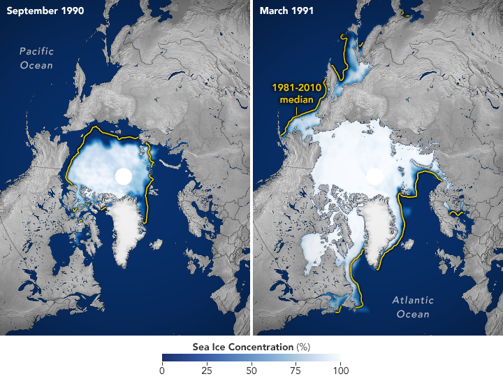
Normally sea ice covers around 14 to 16 million sq. kms in the Arctic by late winter. This declines to approximately 7 million sq. kms in the Arctic summer (see images above). Over the past decade, the Arctic minimum has been only between 3.5 and 5 million sq. kms.
 SMMR and SSM/I
NASA launched the Scanning Multichannel Microwave Radiometer (SMMR) in 1978, and the Defense Meteorological Satellite Program (DMSP) launched the first of the Special Sensor Microwave/Imager (SSM/I) sensors in 1987. Scientists at the Goddard Space Flight Center have combined the SMMR and SSM/I data sets to provide a time series of sea ice data spanning over 30 years.
Trends in sea-ice extent
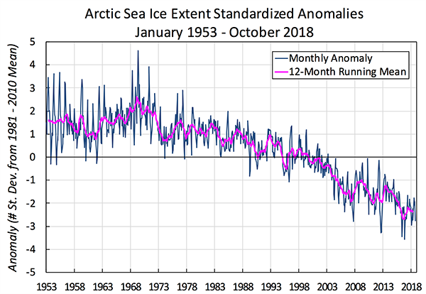
Passive microwave satellite data reveal that, since 1979, winter Arctic ice extent has decreased about 3 percent per decade relative to the 1981-2010 average (Cavalieri and Parkinson 2012).
Satellite data from the SMMR and SSM/I instruments have been combined with earlier observations from ice charts and other sources to yield a time series of Arctic ice extent from the early 1900s onward. While the pre-satellite records are not as reliable, their trends are in good general agreement with the satellite record and indicate that the Arctic sea ice extent has been declining since at least the early 1950s.
 On September 18, 2019, sea ice extent dropped to 4.15 million square kilometers (1.60 million square miles), effectively tied for the second-lowest minimum in the satellite record along with 2007 and 2016. This appears to be the lowest extent of the year. In response to the setting sun and falling temperatures, ice extent will begin increasing through autumn and winter. The 13 lowest extents in the satellite era have all occurred in the last 13 years.
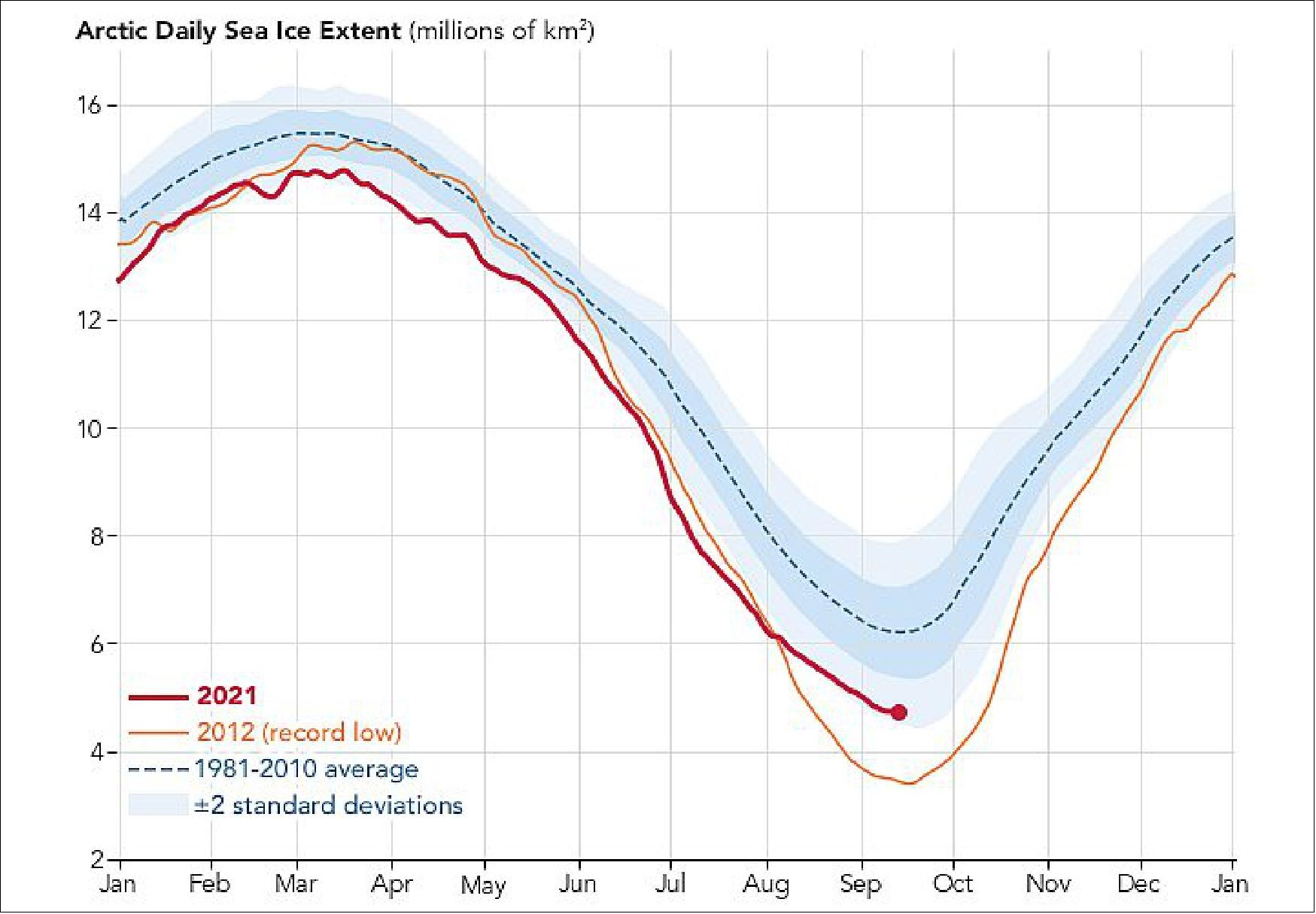
On September 15, 2020, the sea ice was down to 3.74 sq. km, only the second time since the satellite record began in 1979 [https://nsidc.org/arcticseaicenews/2020/09/arctic-sea-ice-decline-stalls-out-at-second-lowest-minimum/]. The December 2021 level was below the 1981-2010 average, and the air temperature was above average. In Greenland, the East Greenland Sea, and north of the Canadian Arctic Archipelago, temperatures were 6 degrees C above average. Eastern Eurasia and northwestern Canada had below-average temperatures.
Credit: National Snow and Ice Data Center.